


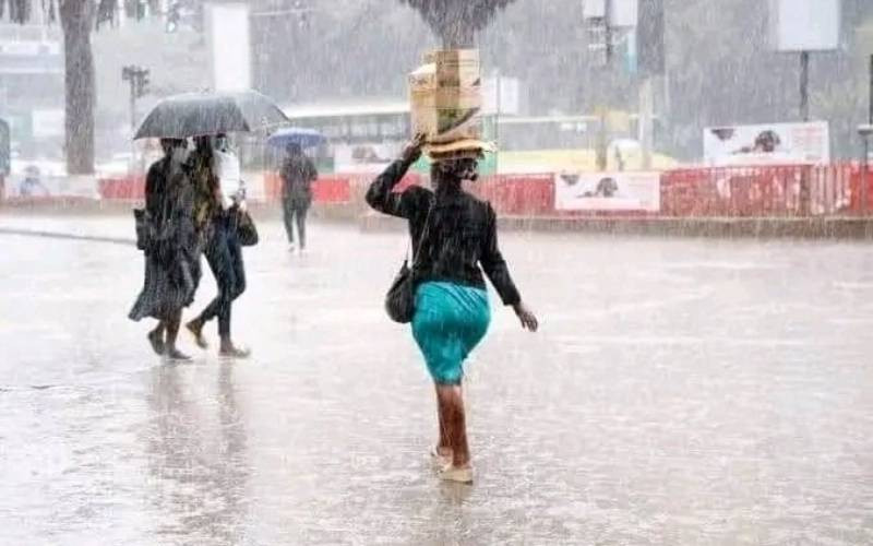
The unusual weather conditions being experienced across the country this August; the increased rainfall is linked to large-scale atmospheric systems.
According to the Acting Director of Kenya Meteorological Services, Edward M. Muriuki said the shifting rainfall patterns are driven by global and regional climate systems.
He said this year’s conditions are proving wetter than normal, with more regions recording higher-than-average rainfall.
“The current cold and wet conditions being experienced over Nairobi, Central Kenya, and the western half of the country are characteristic of August,” Muriuki said.
“However, the improvement in rainfall activities over Nairobi, Central Kenya, Northwest, and parts of the North-eastern and South-eastern lowlands has been caused by a band of convective clouds known as the Madden-Julian Oscillation (MJO).”
He said traditionally, August marks the slow end of the cold season in Central Kenya, including Nairobi and its surroundings, with residents experiencing cloudy mornings and occasional light showers.
The western parts of the country, such as the Rift Valley and Lake Victoria Basin, usually record consistent rainfall, while the coastal and north western regions remain relatively dry. The Madden-Julian Oscillation is a global tropical weather system that moves from west to east across the oceans.
When it reaches the Indian Ocean in phases two and three, it increases rainfall across Kenya. Currently, the system is in phase three and is expected to remain active for the next few days.
Muriuki further noted that a temperature imbalance between the Atlantic and Indian Oceans has contributed to the ongoing wet spell.
“When the Atlantic Ocean is cooler than the Indian Ocean, the pressure gradient between the two pulls rain-causing systems farther eastwards into Central Kenya, including Nairobi,” he stated.
This phenomenon, he added, has been consistent since June, bringing more rainfall than usual in parts of Nairobi and Central Kenya.
Rainfall records from August 12th to 18th confirm the above-normal downpours. Eldoret Airport in Uasin Gishu County received the highest amount at 116.5 millimeters, followed by Butere in Kakamega County at 100.8 millimeters, and Kericho at 78.9 millimeters.
Nairobi has also seen heavier-than-usual showers, with Wilson Airport recording 44.9 millimeters and Dagoretti 41.8 millimeters. Isiolo, Nyeri, Laikipia, and Marsabit counties also reported significant rainfall.
The Meteorological Department emphasized that these conditions had been anticipated in earlier forecasts.
Stay informed. Subscribe to our newsletter
“The current weather conditions were captured in the June–July–August 2025 seasonal forecast, the August 2025 monthly forecast, and our heavy rainfall advisory issued on August 15th,” the statement read.
The rains are expected to persist, particularly in the western half of the country, the northwestern region, parts of Marsabit County, and Central Kenya.
Residents in affected areas have been urged to stay updated through advisories and take precautions against potential flooding, especially in low-lying regions.
As Kenya continues to witness shifting weather patterns influenced by global climate systems, the Meteorological Department reassured citizens of its commitment to timely forecasts.
“We encourage the public to keenly follow our advisories as we closely monitor the evolving weather conditions,” said Muriuki.